
Table of Contents

EL NINO | एल नीनो
EL NINO. परिचय: पृथ्वी की जलवायु को प्रभावित करने वाले असंख्य कारकों में से एक एल नीनो है। इस जलवायु संबंधी घटना ने वैज्ञानिकों, मौसम के प्रति उत्साही लोगों और आम जनता को समान रूप से वैश्विक मौसम पैटर्न पर इसके गहन प्रभाव के लिए आकर्षित किया है। इस ब्लॉग में, हम अल नीनो की आकर्षक दुनिया में तल्लीन होंगे, इसके कारणों, प्रभावों और हमारे ग्रह के प्रभावों की खोज करेंगे।
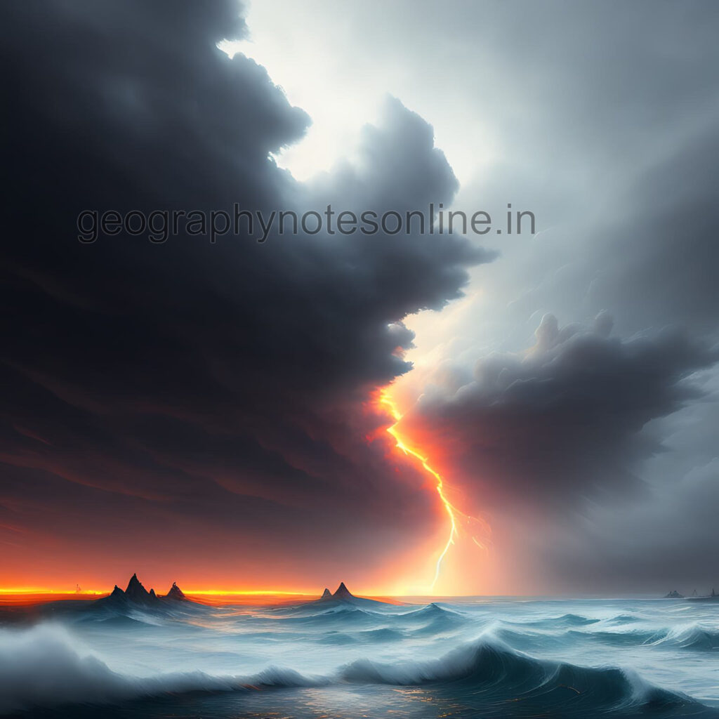
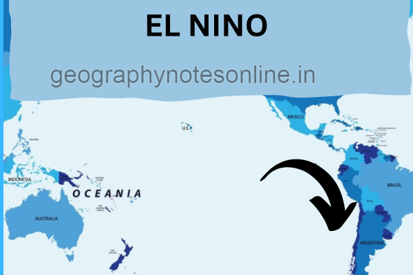
एल नीनो एक गर्म जल की धारा है जो दक्षिणी अमेरिका के पश्चिमी तट पर उत्तर से दक्षिण की और पेरू की धरा के विपरीत प्रवाहित होती है | यह प्रशांत अहसागर के तापमान को बढ़ा देता है जिससे पूर्वी प्रशांत महासागर का उच्च वायुदाब निम्न वायुदाब में परिवर्तित हो जाता है । इसका समकक्ष, ला नीना, सामान्य वायुमंडल की दशा को दर्शाता है जिसमे पूर्वी प्रशांत का तापमान कम एवं बयुदाब उच्च रहता है |
एल नीनो के कारण
अल नीनो के कारण: अल नीनो समुद्र और वायुमंडल के बीच जटिल अंतःक्रिया से उत्पन्न होता है। सामान्य परिस्थितियों में, पूर्व से पश्चिम की ओर तेज़ व्यापारिक हवाएँ चलती हैं, जो सतह के गर्म पानी को पश्चिमी प्रशांत की ओर धकेलती हैं। हालांकि, एक एल नीनो घटना के दौरान, ये हवाएं कमजोर हो जाती हैं या उलट भी जाती हैं, जिससे गर्म पानी पूर्व की ओर पलायन कर जाता है, दक्षिण अमेरिकी तट के पास जमा हो जाता है।
अल नीनो का मौसम पर प्रभाव:
अल नीनो का मौसम पर प्रभाव: अल नीनो के दूरगामी परिणाम होते हैं, जो दुनिया भर में मौसम के मिजाज को प्रभावित करते हैं। इसके प्रभाव से दक्षिणी अमेरिका के तट पर बाढ़ , दक्षिणी एशिया महाद्वीप के विभिन्न क्षेत्रों में गंभीर सूखा और अन्य चरम मौसम की घटनाएं हो सकती हैं। उदाहरण के लिए, अल नीनो घटना के दौरान, दक्षिण अमेरिका के कुछ हिस्सों में अक्सर भारी वर्षा और बाढ़ का अनुभव होता है, जबकि ऑस्ट्रेलिया और दक्षिण पूर्व एशिया जैसे क्षेत्रों में सूखे की स्थिति का सामना करना पड़ सकता है।
वैश्विक प्रभाव:
वैश्विक प्रभाव: अल नीनो का प्रभाव स्थानीय मौसम पैटर्न से परे है। इसका प्रभाव मत्स्य पालन, कृषि को बाधित कर सकता है और यहां तक कि वैश्विक खाद्य कीमतों को भी प्रभावित कर सकता है। उदाहरण के लिए, समुद्र की धाराओं में बदलाव के कारण पेरू के तट पर मछली की आबादी में कमी तटीय समुदायों की आजीविका को प्रभावित कर सकती है जो मछली पकड़ने पर बहुत अधिक निर्भर हैं। इसके अतिरिक्त, वर्षा के परिवर्तित पैटर्न से फसल खराब हो सकती है, जिससे दुनिया के विभिन्न भागों में खाद्य उत्पादन प्रभावित हो सकता है। साथ ही यह भारतीय मानसून को कमजोर करती है |
एल नीनो और जलवायु परिवर्तन:
जबकि अल नीनो सदियों से एक प्राकृतिक जलवायु घटना रही है, इसकी आवृत्ति और तीव्रता पर जलवायु परिवर्तन के संभावित प्रभाव में वैज्ञानिक अनुसंधान जारी है। कुछ अध्ययनों से पता चलता है कि बढ़ते वैश्विक तापमान से भविष्य में अधिक बारंबार और मजबूत एल नीनो घटनाएं हो सकती हैं। संभावित जलवायु परिवर्तन की भविष्यवाणी करने और अनुकूलन करने के लिए इस संबंध को समझना महत्वपूर्ण है।
ला नीना
अल नीनो की छोटी बहन : ला नीना, अल नीनो-दक्षिणी दोलन (ENSO) चक्र के ठंडे चरण के अपने निहितार्थ हैं। यह आम तौर पर एल नीनो घटना का अनुसरण करता है और उष्णकटिबंधीय प्रशांत क्षेत्र में ठंडे-से-सामान्य समुद्र की सतह के तापमान की विशेषता है। ला नीना विपरीत प्रभाव ला सकता है, जैसे दक्षिण पूर्व एशिया और ऑस्ट्रेलिया के कुछ हिस्सों में बारिश में वृद्धि और अटलांटिक में तीव्र तूफान गतिविधि।
निष्कर्ष:
अल नीनो एक पेचीदा और प्रभावशाली जलवायु घटना बनी हुई है जो शोधकर्ताओं और जनता को समान रूप से आकर्षित करती है। इसके कारणों, प्रभावों और निहितार्थों को समझकर, हम पृथ्वी की जटिल जलवायु प्रणाली में मूल्यवान अंतर्दृष्टि प्राप्त कर सकते हैं। अल नीनो का चल रहा अध्ययन एक लचीले भविष्य के लिए अधिक प्रभावी जलवायु परिवर्तन अनुकूलन रणनीतियों में योगदान करते हुए, इसके प्रभावों का अनुमान लगाने और प्रतिक्रिया देने की हमारी क्षमता को बढ़ाने में महत्वपूर्ण भूमिका निभाता है।
एल नीनो क्या है इसका क्या प्रभाव है?
एल नीनो एक गर्म जल की धारा है जो दक्षिणी अमेरिका के पश्चिमी तट पर प्रवाहित होती है | यह प्रशांत महासागर के तापमान को बढ़ा देती है , मानसून को कमजोर कर देती है तथा दक्षिणी अमेरिका के पश्चिमी तट पर प्रचुर मात्रा में वर्षा होती है |
एल नीनो का दूसरा नाम क्या है?
एल नीनो का दूसरा नाम येशु शिशु है |
अल नीनो की खोज किसने की?
एल नीनो की खोज गिल्बर्ट वाकर और जे बरकनीज ने की |
एल नीनो का पर्यावरण पर क्या प्रभाव पड़ता है?
एल नीनो के कारणमानसून कमजोर पड़ जाता है |
 15/05/2023 Interview Letter for Sub Inspector Comb. Comp. Exam – 2021